


For most of the Mid-Atlantic coastline on Oct. 29, 2012, the wind came first, then the water. The boardwalk in Seaside Heights was so overcome by Superstorm Sandy that part of its Casino Pier collapsed, dropping a famed rollercoaster into the ocean like a tablecloth had been pulled beneath it.
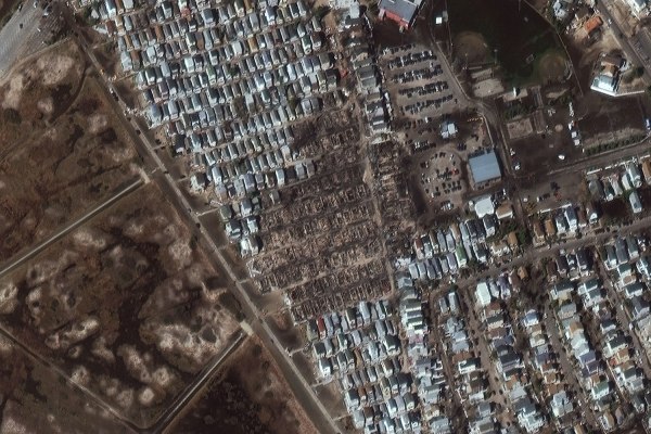
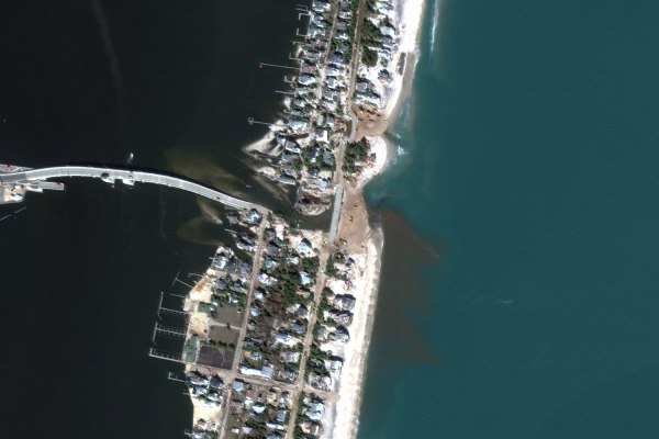
In Ortley Beach and Mantoloking, two quaint shore communities just north of there, beach cottages and multimillion-dollar houses were thrown around like Monopoly pieces. So, too, were the vessels docked at Richmond Yacht Club on Staten Island. And in Breezy Point, on the edge of the Rockaways in Queens, a fire scorched more than 100 homes. A charred and unrecognizable graveyard was left behind.


Stunned homeowners roamed the rubble, looking for any belongings that might have survived. Now and then, they would take a photograph, both to document the damage for their insurance companies and to capture a keepsake of what was left when the water receded.
Hundreds of miles above them, in space, a high-resolution satellite was doing the same thing. It first documented the storm brewing in the Caribbean days earlier and followed its path up the U.S., watching the high winds and relentless currents tear into New Jersey and New York with unprecedented intensity.


Owned by DigitalGlobe, an earth imaging company, the satellite is one of its five that orbit the planet, producing detailed snapshots and embedding geographical information in every pixel. The unclassified data can be used by first-responders to dispatch teams to assist with search-and-rescue or triage in the immediate aftermath of a storm. The archives can later be compiled into before-and-after comparisons, like those below, which can aid coastal planners who are figuring out how best to rebuild.
Despite uncertainty about reconstruction, insurance policies and millions of dollars in undispersed aid, one fact is evident in these images: summer has arrived. The fire-wrecked homes in Breezy Point have been razed and cleared away. In Seaside Heights, a new boardwalk was erected in time for Memorial Day, though it has fewer rides. And in Ortley Beach and Mantoloking, the two towns most devastated by the storm, unsalvageable structures are being demolished. For the areas hit hardest by Sandy, recovery is evident from the ground—and the sky.


Nate Rawlings contributed reporting.